The Warren Historical Commission and Warren Historical Society have
been responsible for the marking of over two dozen historical sites in
our area and they are working on more.
The first historical marker was the Groesbeck marker on Mound Road
between 12 and 13 Mile Roads.
Click on the photos below for a larger
view of the pictures.
| NAME |
LOCATION |
MARKER |
PHOTO |
NOTES |
Arsenal Acres
currently Salvation Army |
24140 Mound Rd.
(E. side, N. of Stephens-9 1/2 Mile Rd.) |
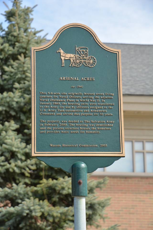 |
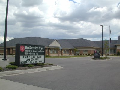 |
More Info |
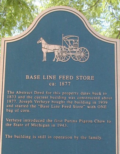
| Base Line Feed Store |
21015 Van Dyke
(W. Side, between Toepfer & Eight Mile Rd.) |
 |
 |
More Info |
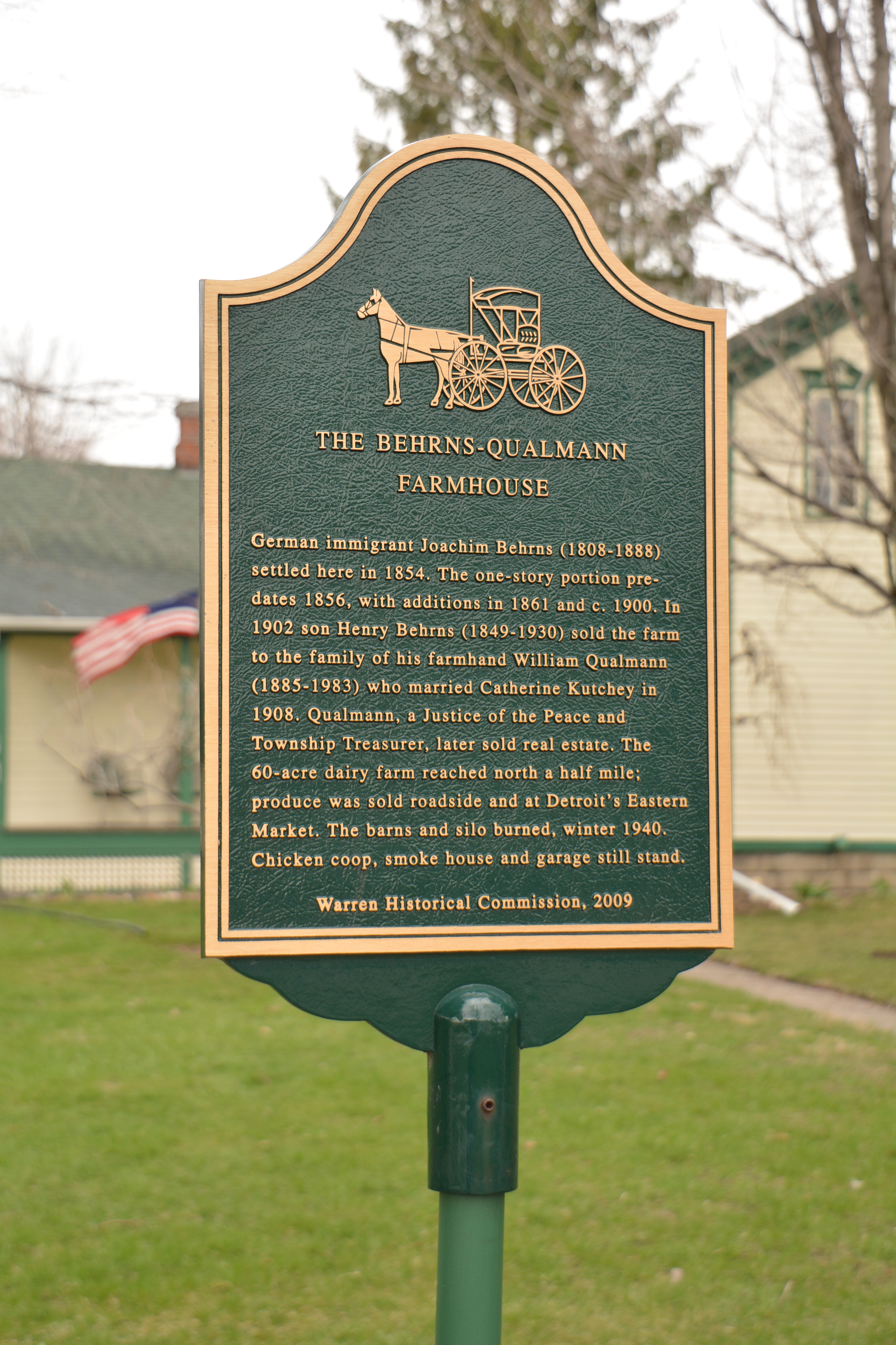
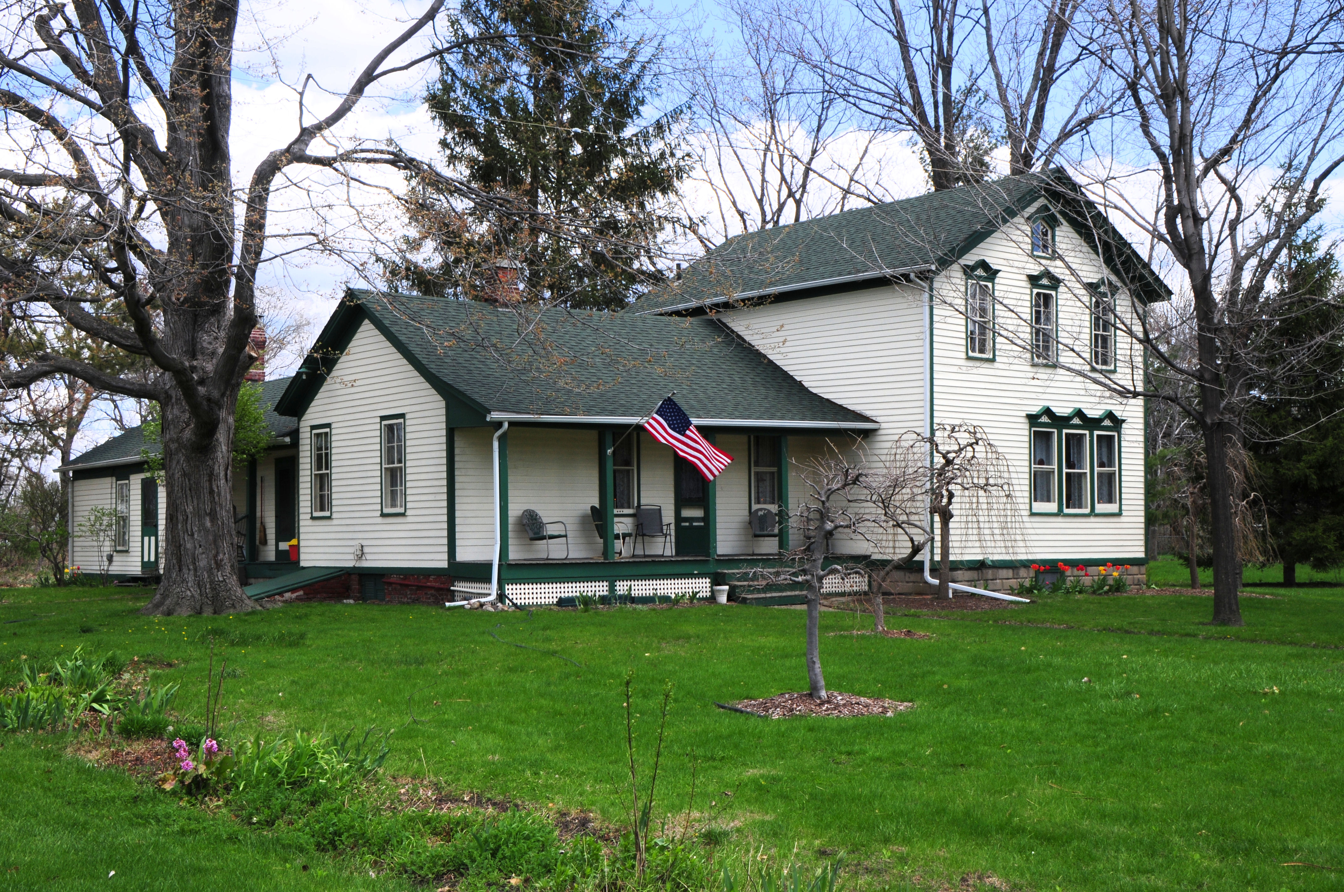
Behrns-Qualmann Home
|
5297 E. 10 Mile Road
(between Ryan & Mound Rds.) |
 |
 |
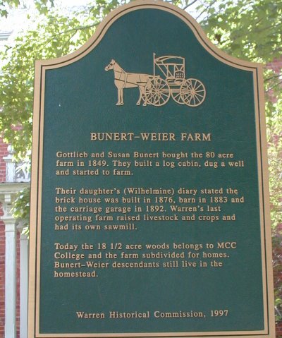
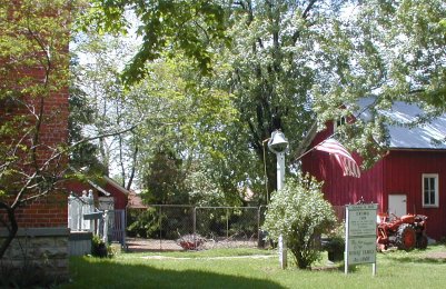
| Bunert-Weier Farm |
28241 Bunert
(W. side, S. of Twelve Mile Rd.) |
 |
 |
More Info |
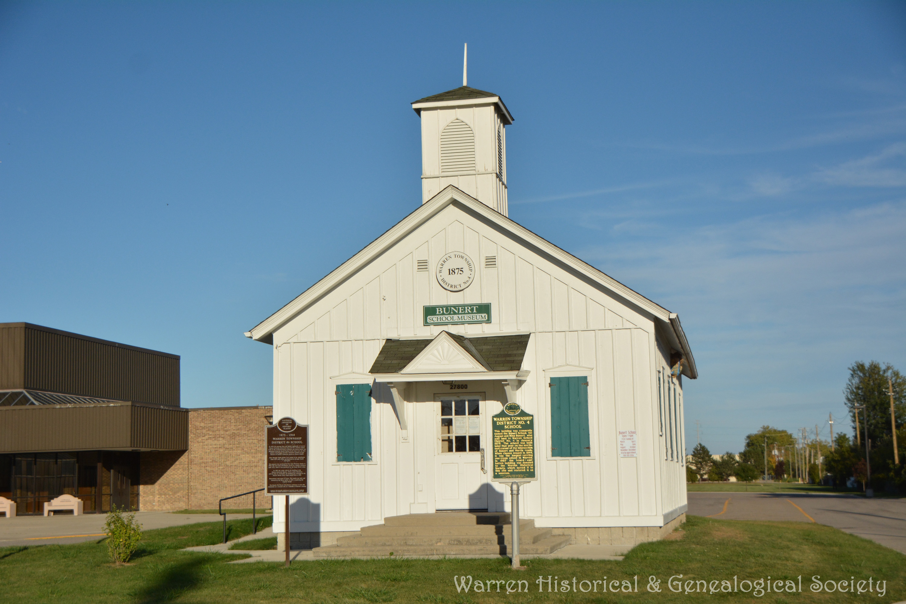
| Bunert One Room School
|
27900 Bunert
(south side of Warren Woods Tower High School) |
  |
 |
More Info |
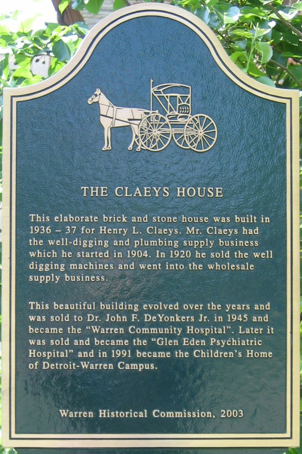
Claeys House
currently SHAR Macomb
|
6902 Chicago Rd.
(S. side, W. of Van Dyke)
|
 |
|
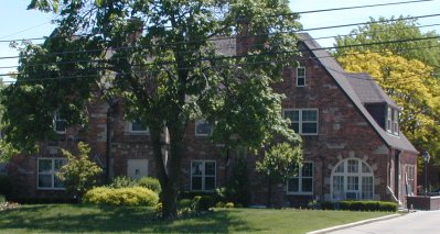
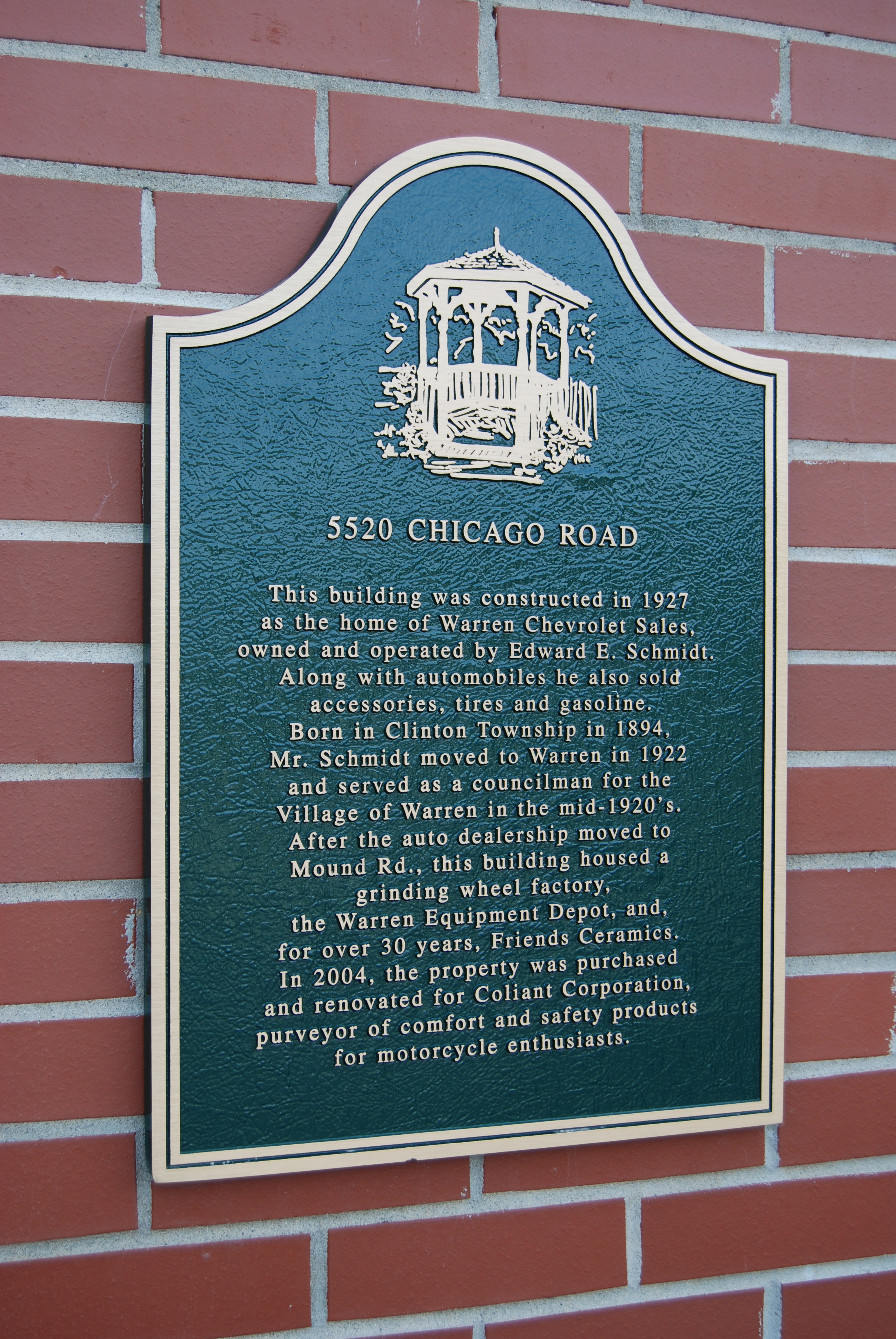
Coliant Corporation
currently Integrated Holdings LLC |
5520 Chicago Road (13 1/2 Mi.)
(between Ryan & Mound Rds.) |
 |
 |
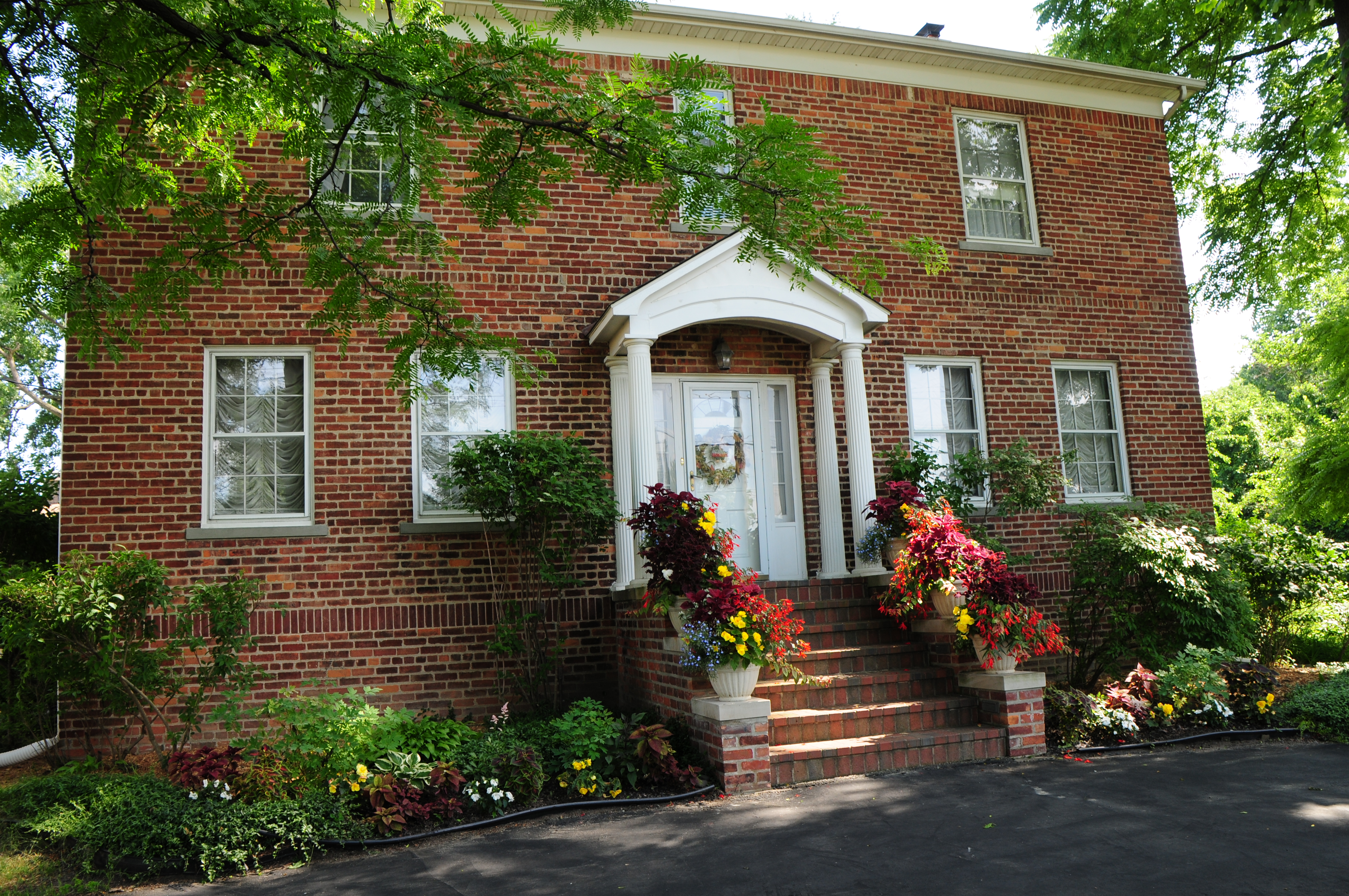
Cutrubes-Seefried House
|
3000 E. 13 Mile Road (13 1/2 Mi.)
(between Ryan & Dequindre Rds.) |
 |
 |
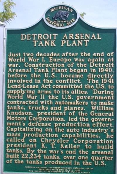
Detroit Arsenal Tank Plant
|
Tank Ave.
(N. of 11 Mile Rd., W. of Van Dyke) |
 |
 |
| Detroit Memorial Cemetery |
4280 E. 13 Mile Road
(Between Ryan & Mound Rds.) |
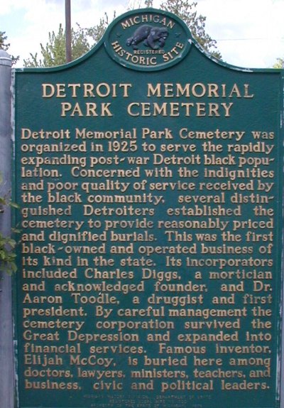 |
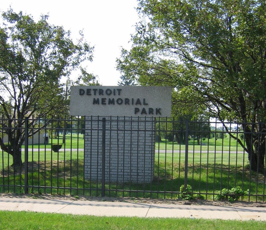 |
More Info |
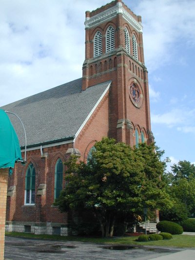
| First Baptist Church of Warren |
31707 Seventh St. at Filmore
(W. of Mound Rd. & S. of Chicago Rd.) |
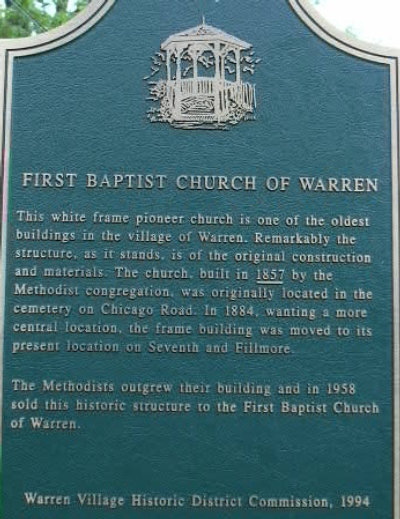 |
 |
More Info |
Fitzgerald Recreation Center/USO |
4355 E. Nine Mile Road
(Between Ryan & Mound Rds.) |
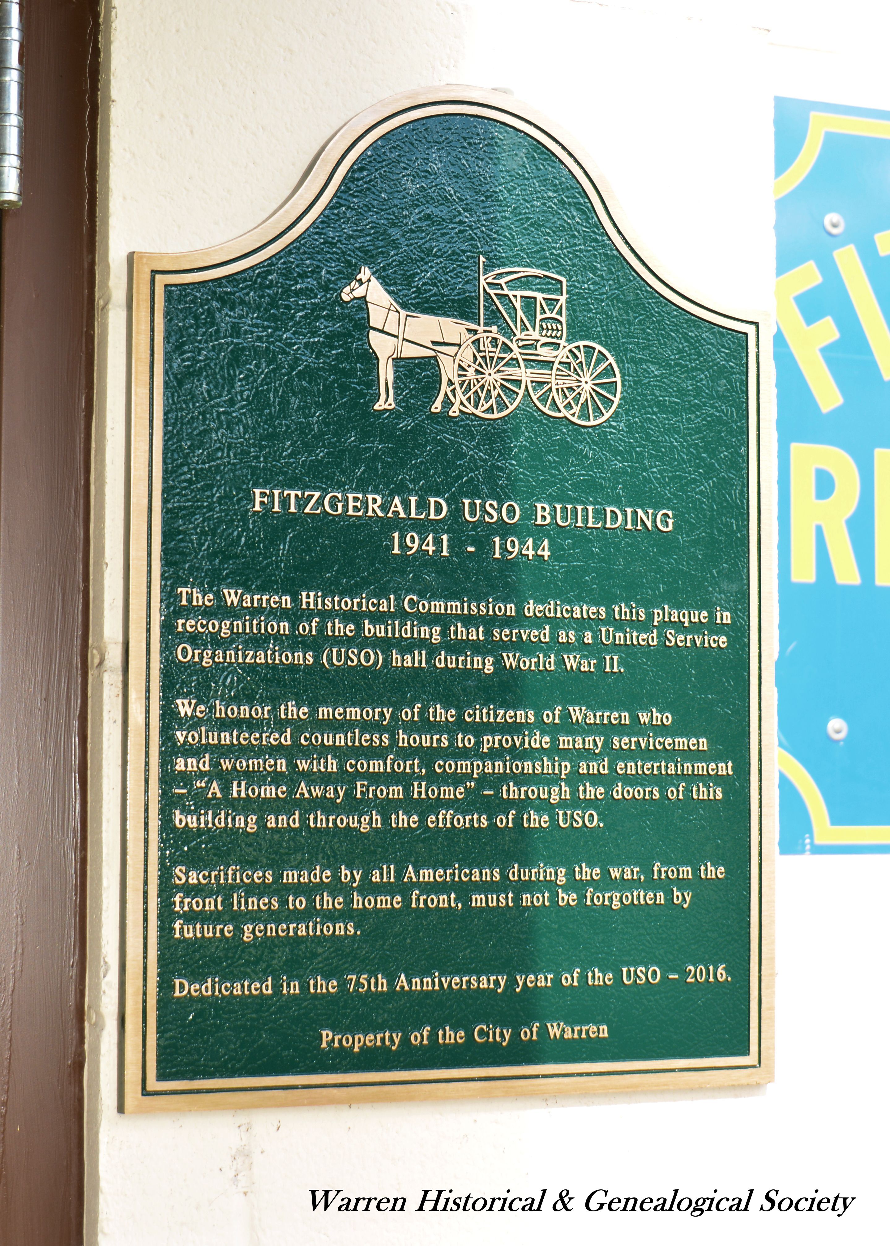 |
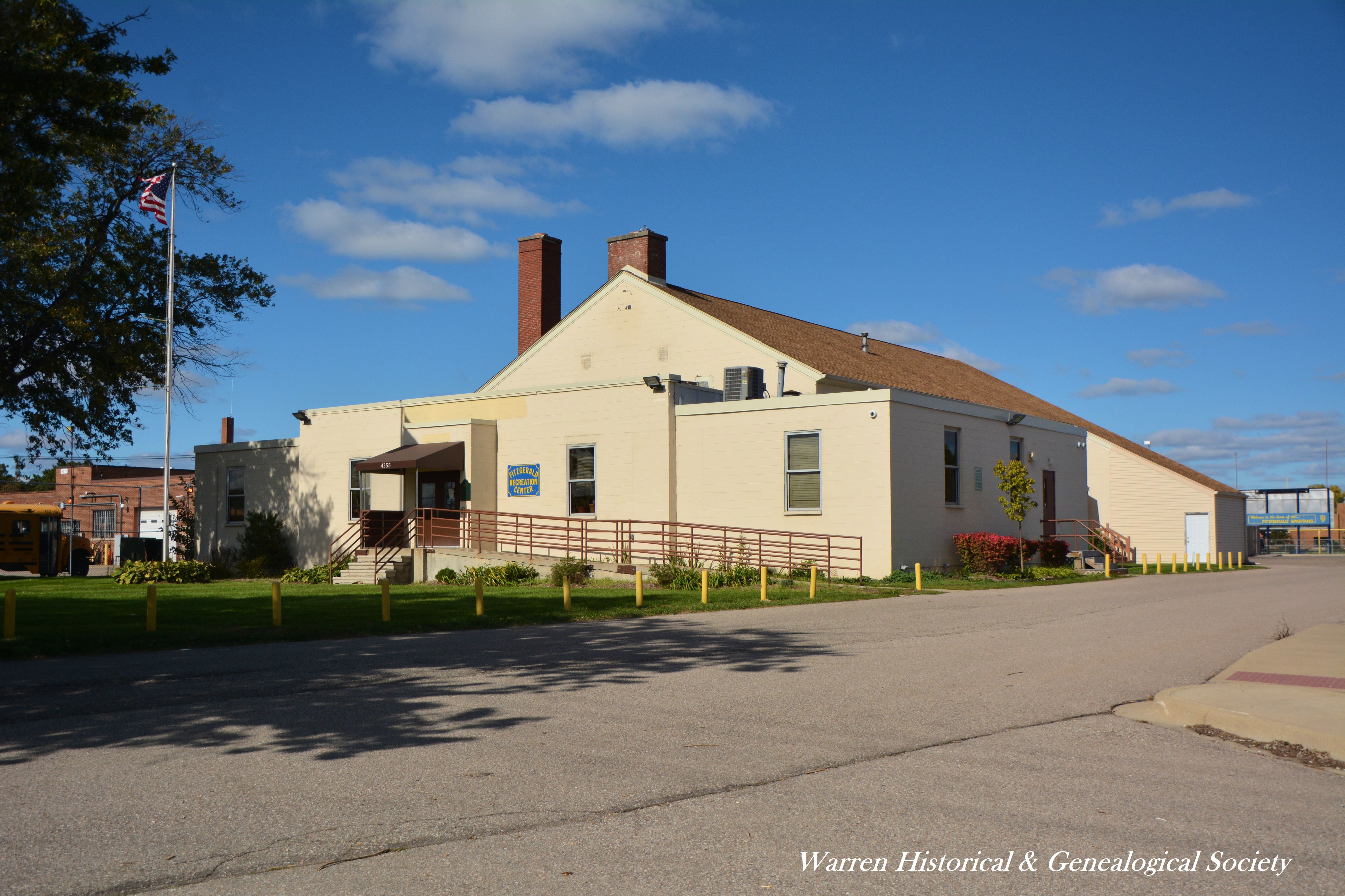 |
More Info |
| Flynn House |
6048 Chicago Rd.
(S. side, E. of Mound) |
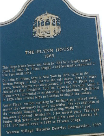 |
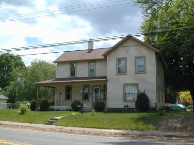 |
More Info |
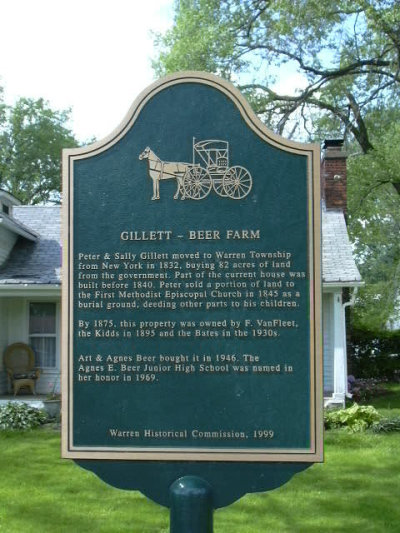
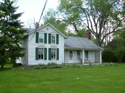
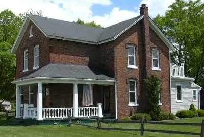
| Gillett-Beer Farm |
4201 Chicago Rd.
(N. side, E. of Ryan Rd.) |
 |
 |
More Info |
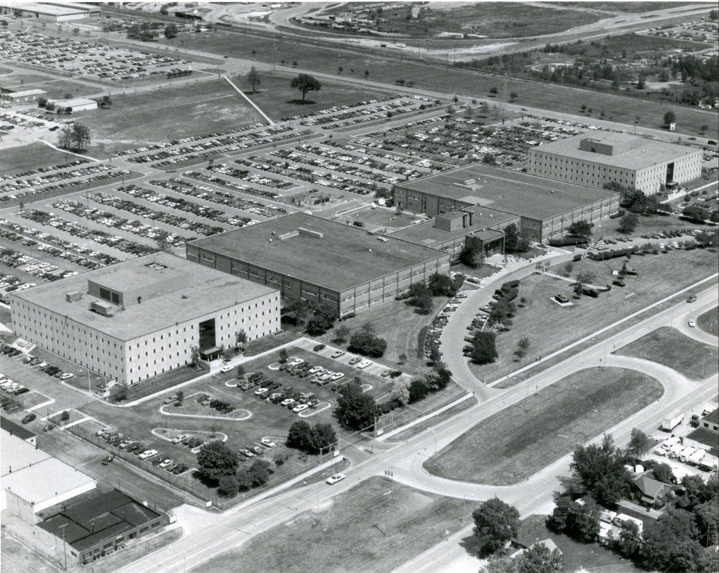
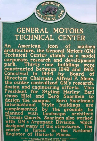
GM Tech Center
GM Heritage Center |
East side of Mound Rd.
(between 12 Mile Rd. and 13 Mile Rd., at the GM Tech Center entrance) |
 |
 |
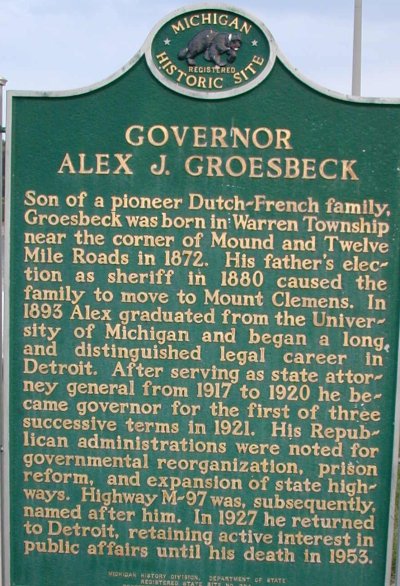
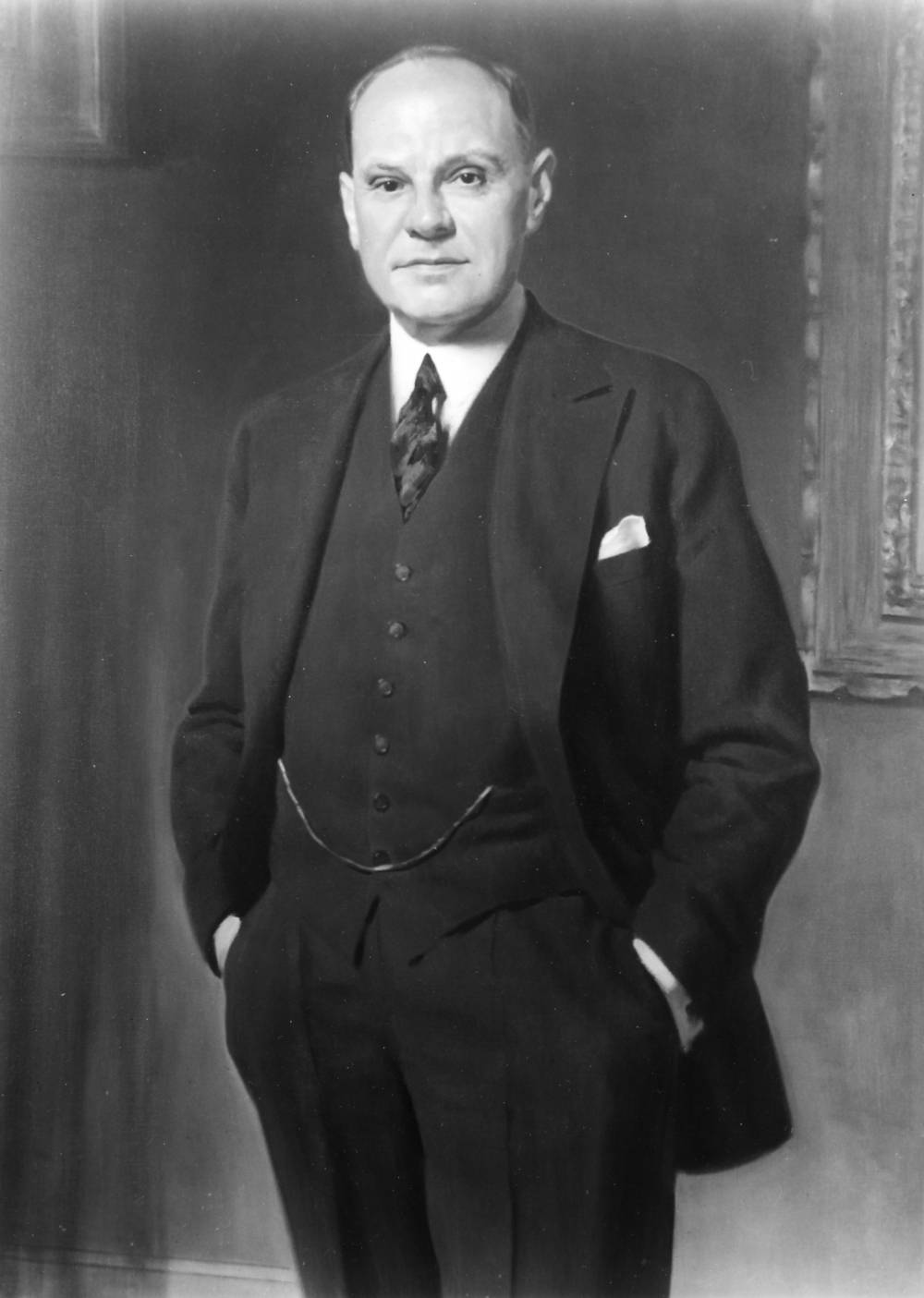
| Gov. Alex J. Groesbeck |
East side of Mound Rd.
(between 12 Mile Rd. and 13 Mile Rd., at the GM Tech Center entrance) |
 |
 |
More Info |
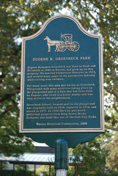
Eugene B. Groesbeck Park
|
22221 Memphis Ave.
(S. of 9 Mile Rd. & E. of Van Dyke) |
 |
 |
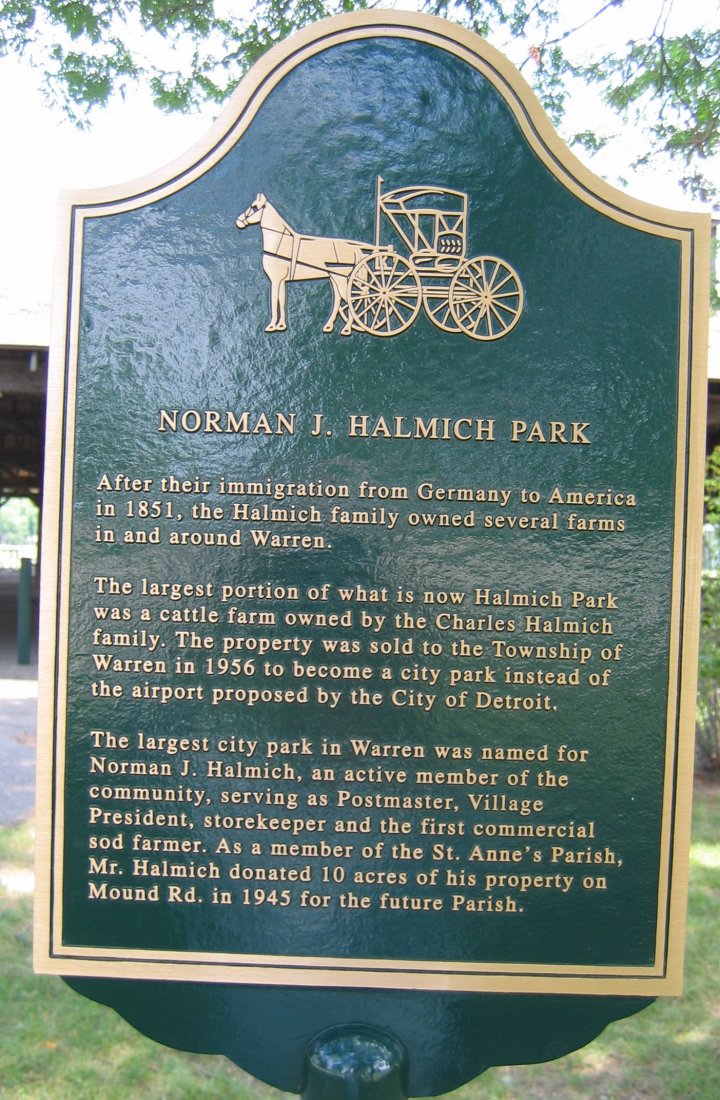
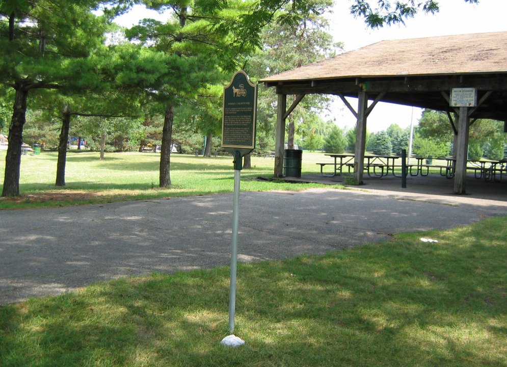
Norman Halmich Park
|
3001 E. 13 Mile Road
(between Ryan and Dequindre Rds.) |
 |
 |
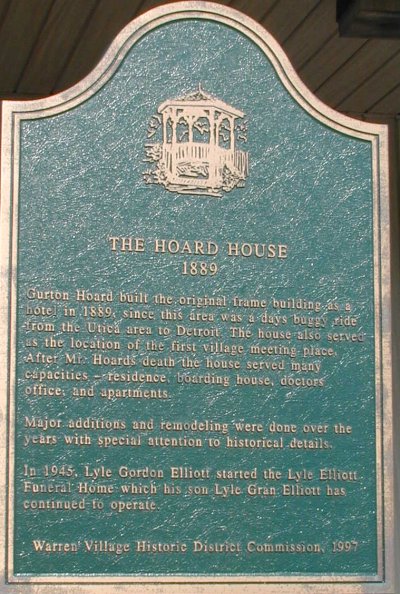
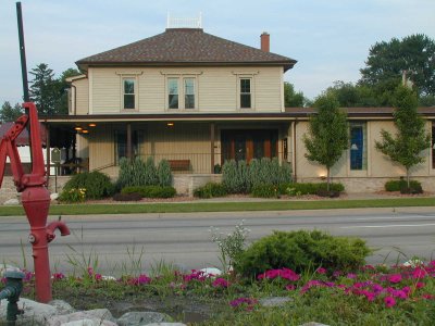
Hoard House
currently Lyle Elliott Funeral Home |
31730 Mound Rd.
(E. side, S. of Chicago Rd.) |
 |
 |
More Info |
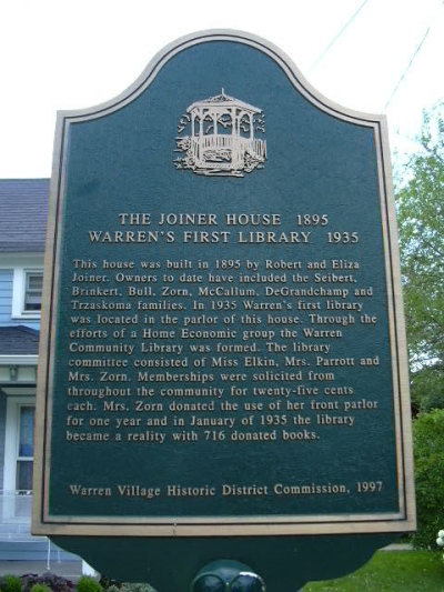
| Joiner House |
31715 Seventh St.
(W. of Mound Rd. & S. of Chicago Rd.) |
 |
 |
More Info |
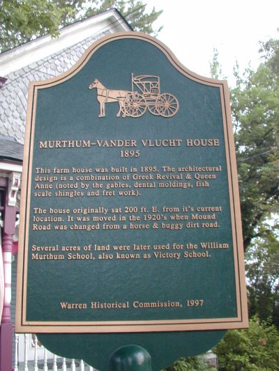
| Murthum-Vandervlucht House |
5820 Murthum
(W. of Mound Rd. & N. of Chicago Rd.) |
 |
 |
More Info |
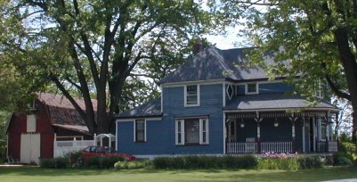
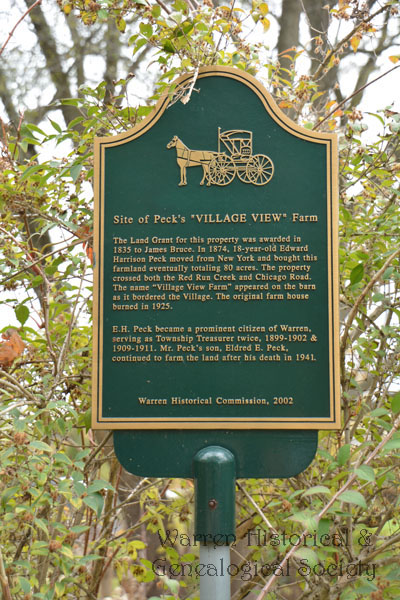
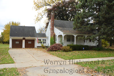
| Peck's "Village View" Farm |
4881 Chicago Rd.
(Between Mound Rd. & Ryan Rd.) |
 |
 |
|
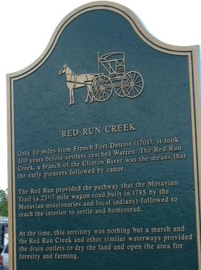
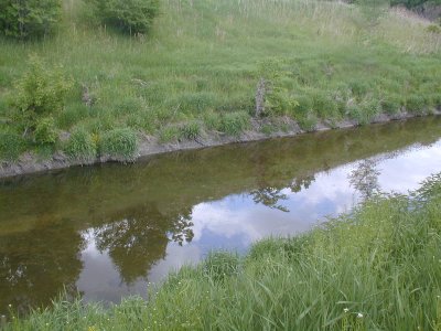
| Red Run Creek |
Mound Rd. (N. of Chicago Rd., both sides of the road)
and Van Dyke (N. of Chicago Rd., both sides of the road) |
 |
 |
More Info |
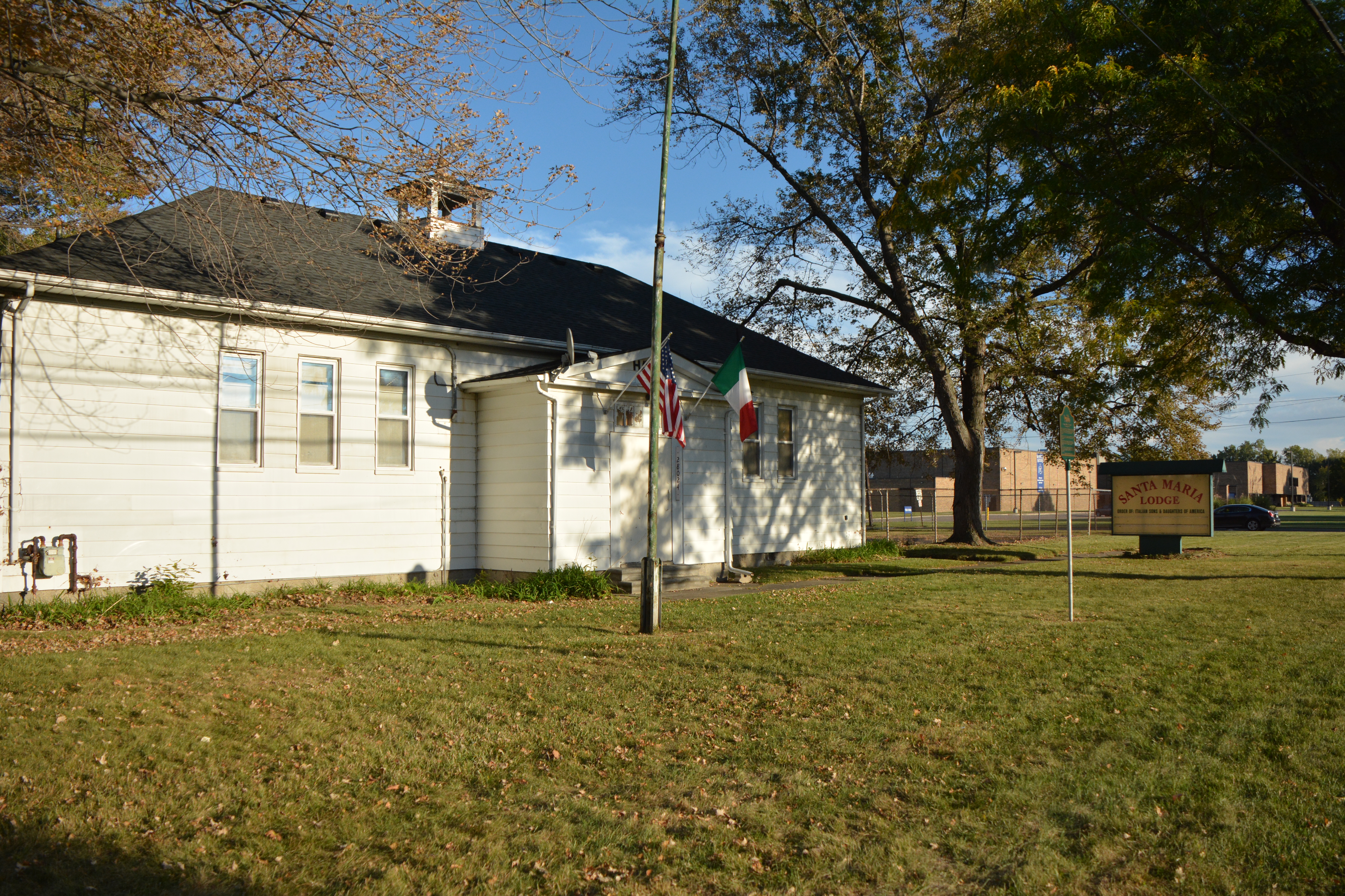
School District #4 Two Room Schoolhouse
currently Santa Maria Lodge
|
28024 Bunert Road
(between 11 & 12 Mile Rds.) |
 |
 |
| St. Paul United Church of Christ |
31654 Mound Rd.
(E. side, S. of Chicago Rd.) |
 |
 |
More Info |
| Theisen House |
12240 10 Mile Rd.
(S. side, E. of Hoover Rd.) |
 |
 |
More Info |
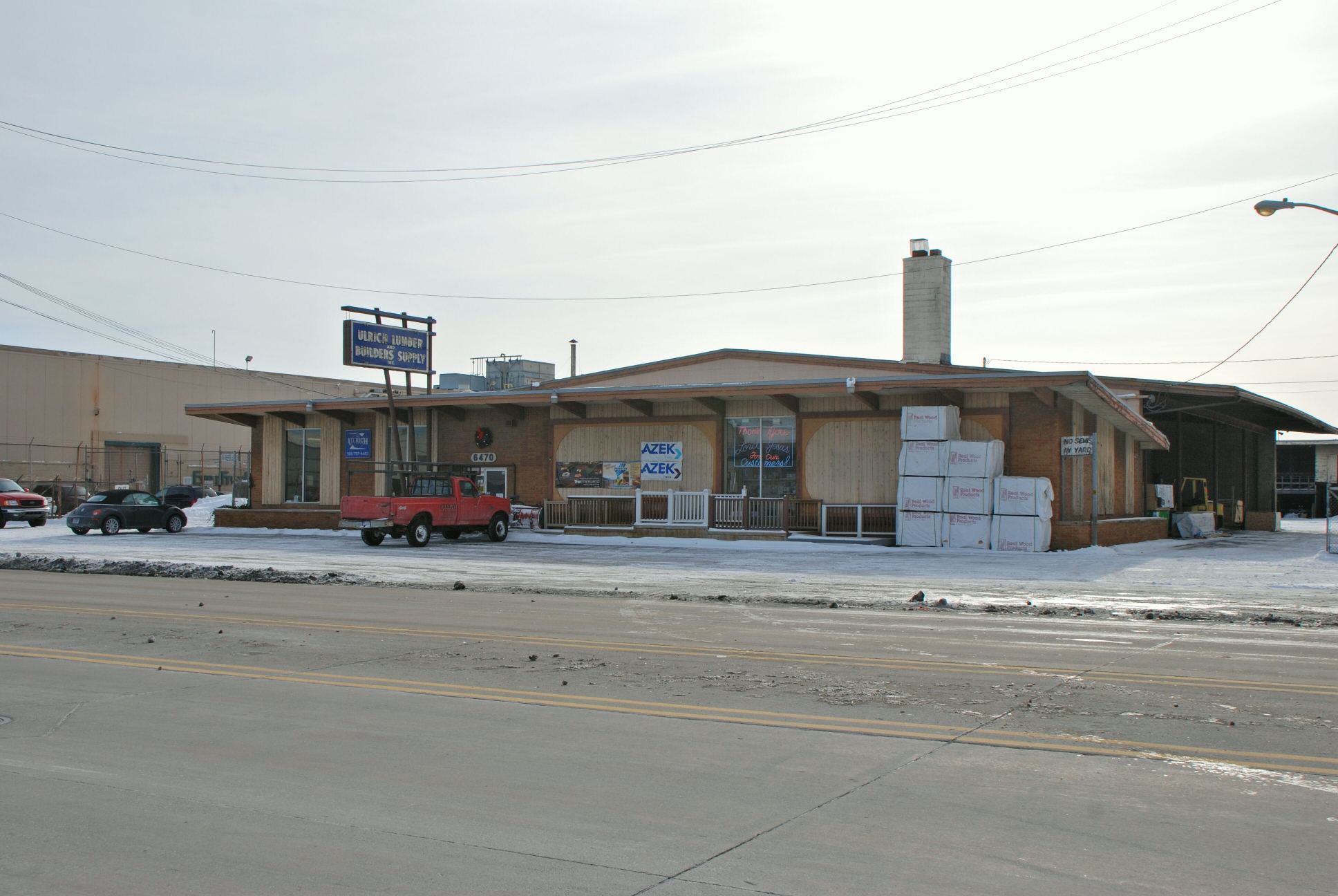
Ulrich Lumber Company
currently Kimberly Fence
|
6470 E. 9 Mile Road
(between Mound & Van Dyke Rds.) |
 |
 |
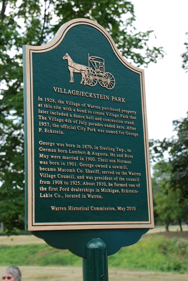
Village/Eckstein Park
|
31948 Mound Road
(between Chicago & 14 Mile Rds.) |
 |
 |
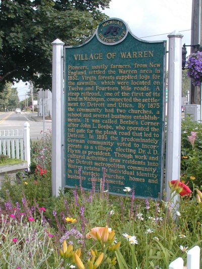
| Village of Warren |
Chicago Rd. & Mound Rd.
(In the median N. of Chicago Rd.)
BEING REFURBISHED |
 |
 |
More Info |
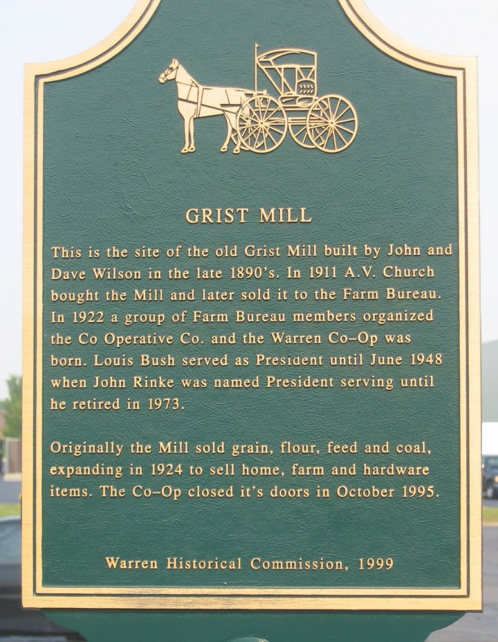
| Warren Co-Operative Company |
Chicago Rd. at the R.R. Crossing
(N. side of Chicago Rd., W. of Van Dyke) |
 |
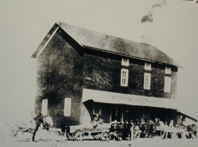 |
More Info |
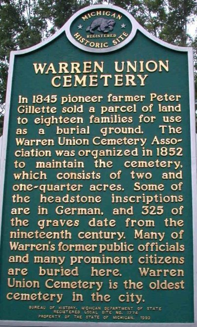
| Warren Union Cemetery |
4433 Chicago Rd.
(N. side of Chicago Rd., E. of Ryan Rd.) |
 |
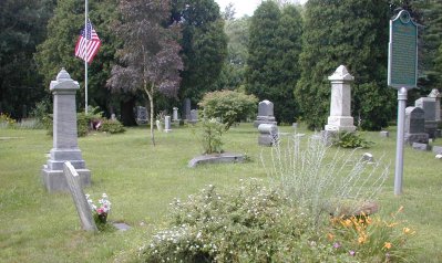 |
More Info |
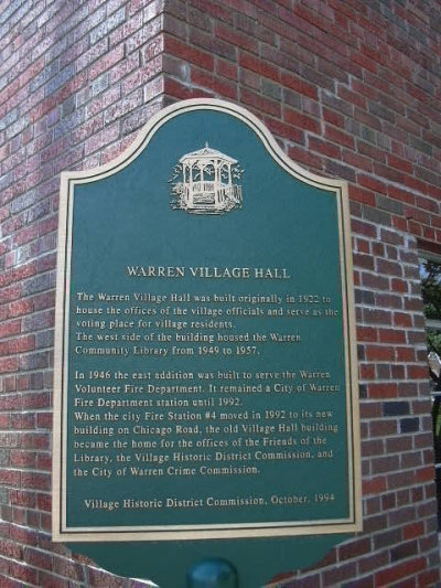
| Warren Village Hall |
5961 Beebe at Flynn
(N. of 13 Mile Rd., E. of Mound Rd.) |
 |
 |
More Info |
Wiegand Park |
8700 Toepfer Rd.
(Between 8 & 9 Mile Rds.) |
 |
 |
More Info |
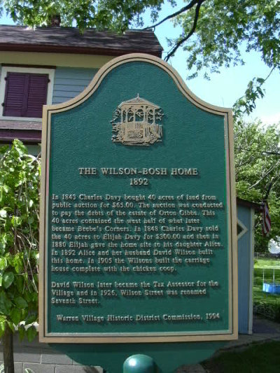
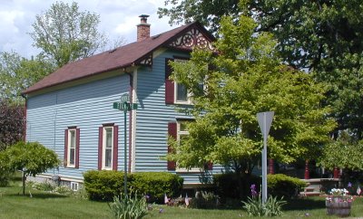
| Wilson-Bosh Home |
5711 Filmore at 7th St.
(S. of Chicago Rd., W. of Mound Rd.) |
 |
 |
More Info |
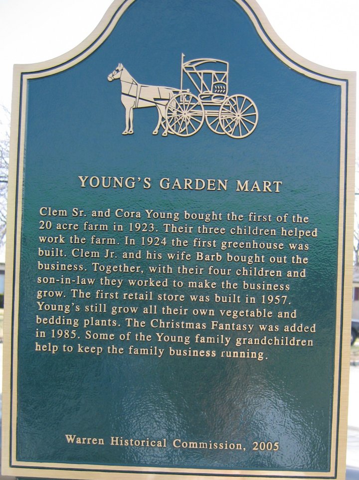
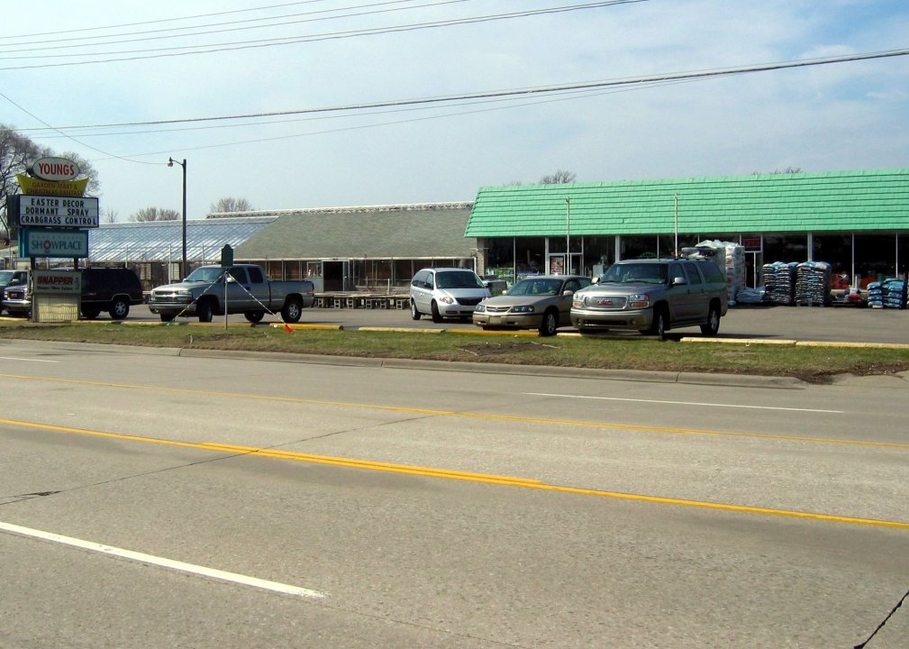
Young's Garden Mart
currently Kutchey Family Farm Market
|
27825 Ryan Road
(between 11 & 12 Mile Rds.) |
 |
 |
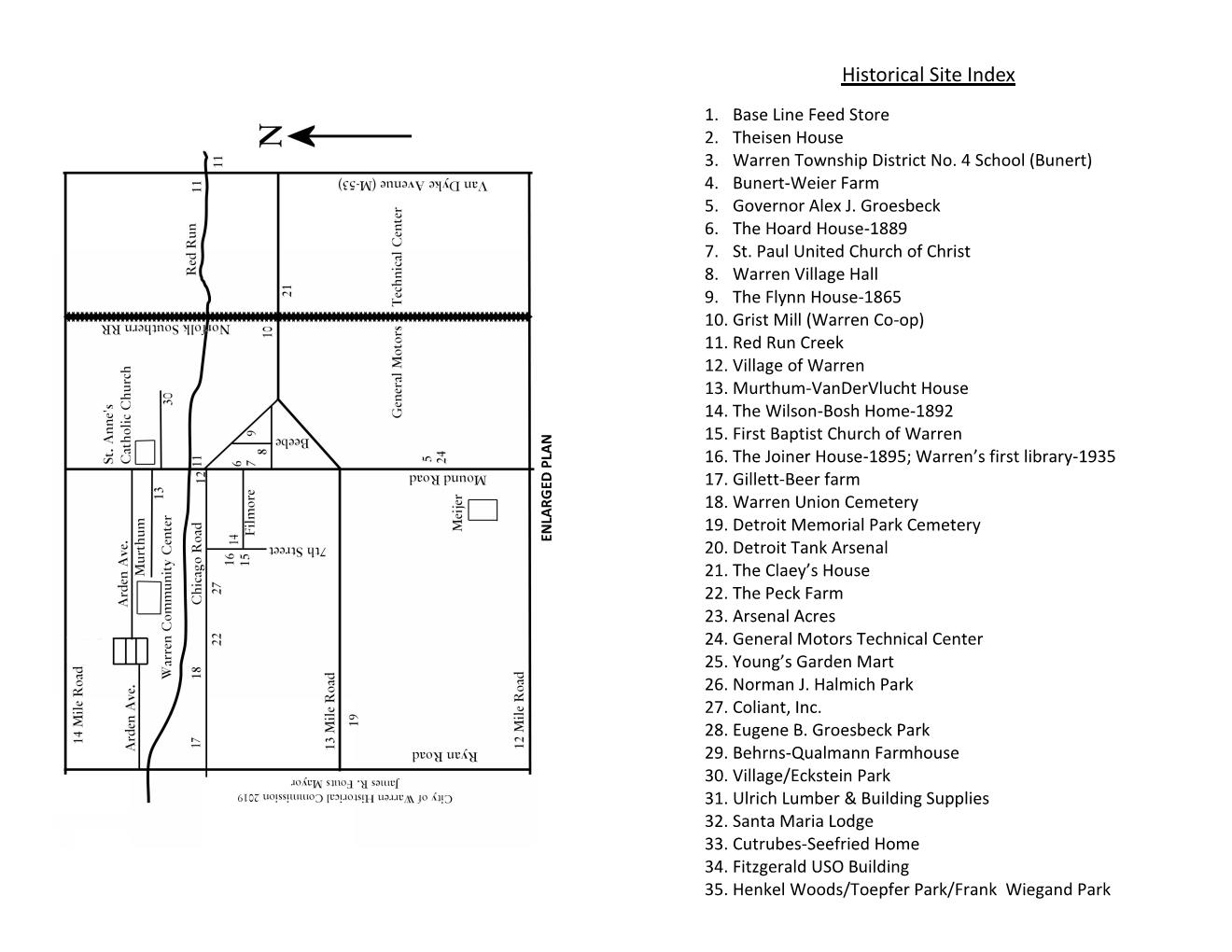
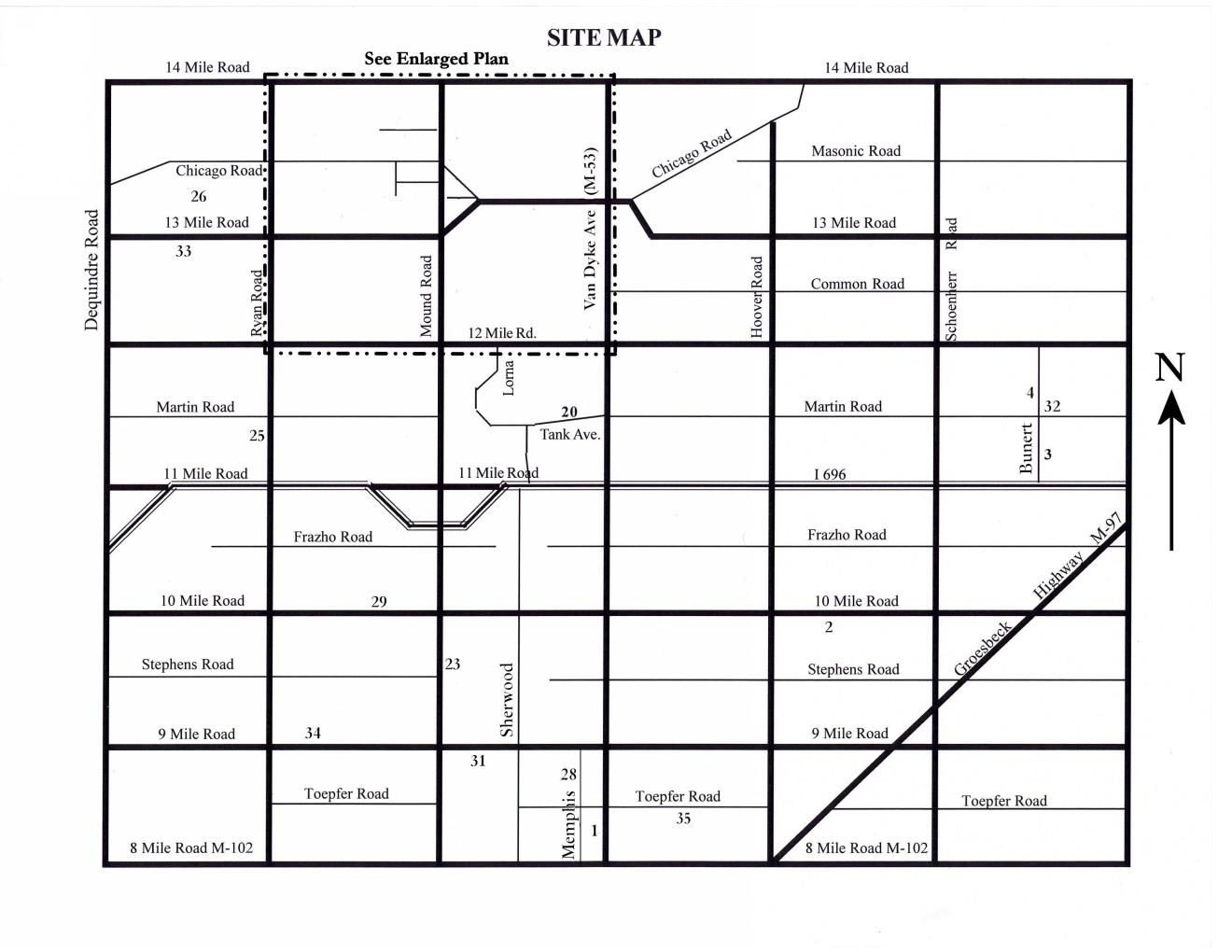
MAP of Sites
|

|

|
|
|
|